|
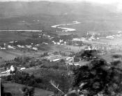
Deerfield Panorama
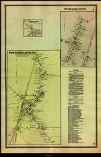
"Deerfield Centre/South Deerfield"
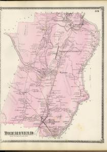
"Deerfield"
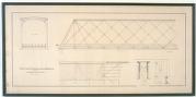
"Plan of Sunderland Bridge over the Connecticut River"
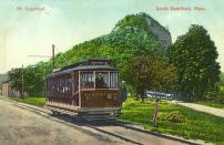
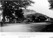
Mt. Sugarloaf and Trolley
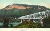
Sunderland Bridge and Sugar Loaf Mountain
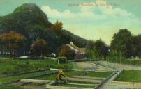
Mt. Sugarloaf with farmer
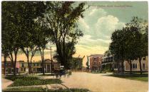
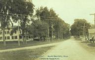
The Centre, South Deerfield, Mass.
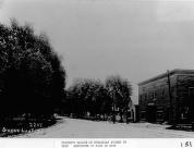
Sugarloaf Street with Trolley
Fisher's Garage under Construction
Deerfield Inn and Trolley
Sugarloaf Street
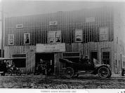
Fisher's Garage
|
Summary and Objective
Students will understand that the changes in transporation routes affects the layout of the land and relationships in human geography. They will use related literature, photos from the American Centuries web site, Deerfield town maps and oral histories to chart the growth of Deerfield and the affects it has had on local Deerfield residents.
Teaching Plan
Step 1.
Pre-activity: Using the American Centuries web site, print selected pictures depicting Deerfield from the past. Collect a copy of the 1871 and present map of Deerfield from the Town Hall.
Step 2.
Pre-activity: Read the story "The Little House" written by Virginia Lee Burton.
Step 3.
Observe and discuss the historic pictures of Deerfield and the two maps of Deerfield, 1871 and the present; looking particulary at the major transportation routes in the two maps.
Step 4.
Assign students to interview someone they know locally in Deerfield who is of older age with the following questions. 1. "How long have you lived in the Deerfield area?" 2. How has the layout of transportation routes affected your life? i.e. paved roads, new roads, interstate 91." 3. "With these new roads, how has it affected the population of Deerfield?" 4. In your opinion, what "good" and "not so good" changes occured in your lifetime due to the growth of Deerfield?"
Step 5.
Post Activity: Discuss and chart the growth, advantages and disadvantages of how transportation routes have affected local Deerfield residents.
Step 6.
Post Activity: Have the students draw a map of their bedroom or on a larger scale, their home. Have them study their drawings and let them create another map allowing them to change the routes (walk ways) to see if they could be more effective getting from one place to another.
|


