Send an E-Postcard of:
"Buckland"
(c) Pocumtuck Valley Memorial Association, Deerfield MA. All rights reserved.
Contact us for information about using this image.
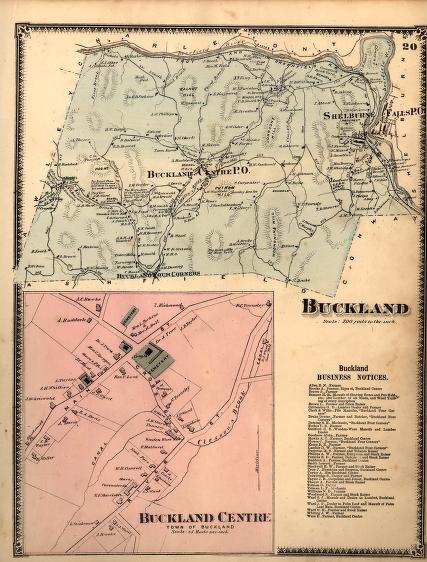
In 1871, as today, the population of the town of Buckland, Massachusetts, clustered along the two major valleys defining the town: around Clesson Brook and along the Deerfield River especially at Shelburne Falls. There was some rural industry then, as evidenced by the tannery and wooden ware manufactory in Buckland Center, along with the occasional woolen or saw mill. But the presence of the Troy and Greenfield Railroad and the ready water power at Shelburne Falls meant that the population of the town had shifted decisively toward Shelburne. Buckland, then as now, remained a rural town defined by its high hills; one, the hill rising above the birthplace of Buckland's most famous former resident Mary Lyon, has now been renamed after her.
top of page
|
|


