Send an E-Postcard of:
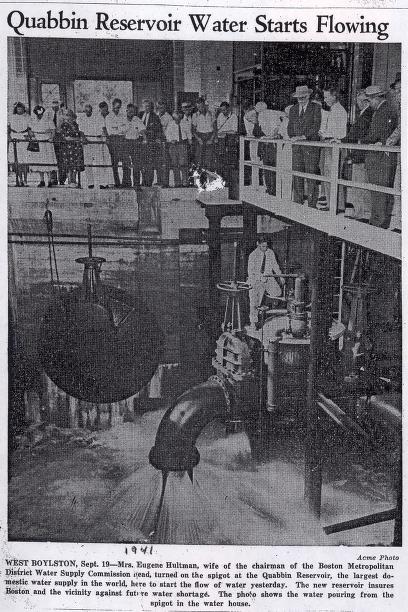
"Quabbin Reservoir Water Starts Flowing" article from Quabbin Reservoir scrapbook
(c) Pocumtuck Valley Memorial Association, Deerfield MA. All rights reserved.
Contact us for information about using this image.
In the 1920s eastern Massachusetts residents placed an increasing demand on their water supply, leading the state to seek new sources. The Quabbin reservoir was created by damming the Swift River and flooding four towns in central Massachusetts. While the state unincorporated these towns on April 28, 1938, the water did not flow out of the reservoir until September 17, 1941. The Quabbin and the companion Wachuset Reservoir were connected with a two way tunnel that allows for maximum storage capacity and supply by utilizing Ware River runoff. The Wachuset Reservoir was one of the largest in the nation and world until creation of the Quabbin. The Quabbin did not fill to capacity until June 22, 1946 at an approximate 412 billion gallons.
top of page
|
|


