Send an E-Postcard of:
South Hadley
(c) Pocumtuck Valley Memorial Association, Deerfield MA. All rights reserved.
Contact us for information about using this image.
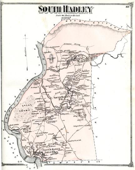
This map shows the town of South Hadley, Massachusetts, on the east side of the Connecticut River opposite Holyoke, in 1873. Originally part of the colonial town of Hadley, South Hadley became a district in 1753 and an official town in 1776. The town was originally agricultural but also well known for a transportation canal constructed around the Holyoke dam in the 1790s. By the time of this map, Hadley was also dotted with small industries, including textile and paper mills. A close look at the map shows Mt. Holyoke Seminary, the forerunner of today's Mt Holyoke College (buildings labeled "sem" just above "South Hadley PO" on the map). At the very top of the map, on the summit of Mt.Holyoke, is the "French Prospect House," a popular tourist destimation.
top of page
|
|


