Send an E-Postcard of:
Mt. Sugarloaf
(c) Pocumtuck Valley Memorial Association, Deerfield MA. All rights reserved.
Contact us for information about using this image.
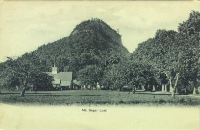
Mt. Sugarloaf rises some 700 feet above the Connecticut Valley in South Deerfield, Massachusetts. From it, a remarkably scenic view extends southward to the Holyoke Range, westward to the rising Berkshires, and to the east to the highlands forming the edge of the Connecticut Valley. Beginning in the early 1820s, significant numbers of tourists began traveling from Boston through Northampton and Hadley on their way to the mineral springs of New York State. They gave the more accessible peaks of the Holyoke Range their earliest attention, and as early as 1825 a platform had been built atop what is now Mt. Skinner (then Mt. Holyoke). Mt. Sugarloaf, like nearly all the most prominent mountains of the central Connecticut Valley, received its own mountain house. It was built by Dwight Jewett in 1864. Jewett also cut the road which extended from the base around the back of the mountain.
top of page
|
|


