15 items have been found that match your search request.
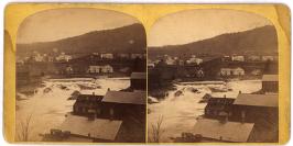 |
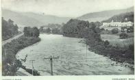
Shelburne Falls, Mass.
1993.16.02
This image, taken in October 1869 by a local photographer, depicts the dam and swollen Deerfield River shortly after a massive flood destroyed bridges, factory buildings, mills and homes. |
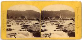 |
Shelburne Falls
1993.16.05
The falls of Shelburne Falls have been an important part of community life for centuries and its potholes continue to be a source of wonder. |
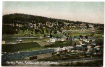 |
Farley, Mass., Rattlesnake Mt. in Distance
1997.08.01.0103
Farley, Massachusetts, is located on a falls of the Millers River between Millers Falls and Erving. It was the site of several manufacturing plants in the late 19th century. |
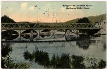 |
Bridge over Deerfield River, Shelburne Falls, Mass.
1913
1999.03.0064
The three sections of this iron riveted lattice bridge meet to span the 320 feet of the Deerfield River. |
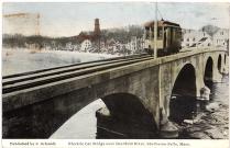 |
Electric Car Bridge over Deerfield River, Shelburne Falls, Mass.
1999.03.0075
Trolleys were responsible for giving residents, farmers and manufacturers a link to the railroad. |
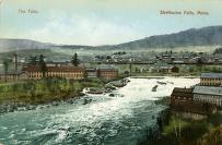 |
"The Falls, Shelburne Falls, Mass."
c. 1915
M.84
Shelburne Falls is a village made up of the business districts of Buckland and Shelburne. |
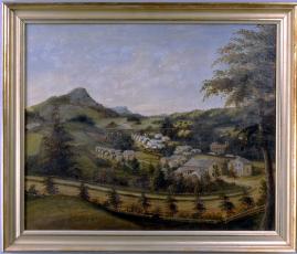 |
View of Cheapside
1958.02
Around 1862, a German artist painted this view of Cheapside, an area of Deerfield, Massachusetts, where many Irish and German immigrants lived. |
 |
Deerfield River
1997.08.01.0067
The Deerfield River runs through the length of the town of Charlemont, Massachusetts, and although it was not used for power in the town's early days, it now offers important recreational opportunities. |
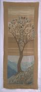 |
Wallhanging-"The Pear Tree"
c. 1911
NBW.108
Ellen Miller and Margaret Whiting provided creative direction to the members of the Deerfield Society of Blue and White Needlework. |
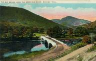 |
The Big Bridge over the Deerfield River
1930
1999.03.0034
A new bridge across the Deerfield River was completed along the Mohawk Trail (Massachusetts State Route 2) in 1914, the first step toward making the route a conduit for tourism. |


