82 items have been found that match your search request.
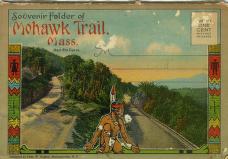 |
Souvenir Folder of Mohawk Trail, Mass.
c. 1915
1999.03.0038.cv
The Native American depicted on the cover of this souvenir of the Mohawk Trail (Massachusetts Route 2) was used to sell the road as a tourist attraction of the 1920s. |
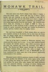 |
Mohawk Trail explanatory text
c. 1915
1999.03.0038.bc
The text of this postcard described the scenic and seasonal beauties of the Mohawk Trail in western Massachusetts. |
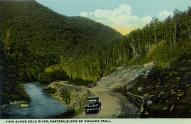 |
View Along the Cold River, Eastern Slope of Mohawk Trail
c. 1915
1999.03.0038.16
This section of the Mohawk Trail in western Massachusetts runs beside the Cold River. |
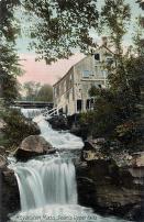 |
Landscape - Mill on Stream
c. 1900
1997.08.01.132
Doane's Falls, in Royalston, Massachusetts, are named after Amos Doane who owned the land around them |
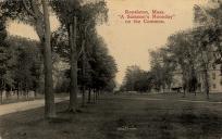 |
Streetscape - Royalston Common
c. 1914
1997.08.01.134
Royalston, Massachusetts, established as a town in 1765, is situated in the northwest corner of Worcester County. |
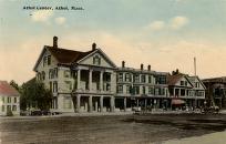 |
Streetscape - Athol Center
c. 1900
2005.45.500
This view of Main Street in Athol, Massachusetts, shows that the street was
not paved at the turn of the 20th century. |
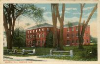 |
"Memorial Hall, Deerfield, Mass."
c. 1910
M.75
The famous American architect Asher Benjamin designed the first Deerfield Academy building, which became the Memorial Hall Museum in 1880. |
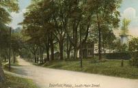 |
"Deerfield, Mass., South Main Street"
c. 1920
M.76
Formerly known as Bloody Brook or Muddy Brook, South Deerfield petitioned to be set off from the town of Deerfield in 1809. |
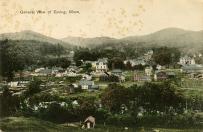 |
"General View of Erving, Mass."
Jun 13, 1913
M.77
Many of the buildings seen in this picture are still a familiar site in the town of Erving, Massachusetts. |
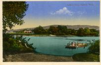 |
"Hatfield Ferry, Hatfield, Mass."
c. 1920
M.79
Ferries were a convenient way of getting across the Connecticut River and remained in use even after railroad, trolley, and foot bridges spanned the river. |


