


Advanced Search
| Online Collection |
|
||||||||||||||||||||||
|
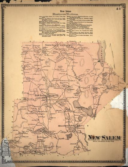
In 1871, New Salem, Massachusetts was in the midst of a decline from the high point of its population in 1820. However, this map shows the rural industry that was still functioning, including the grist and saw mills on Thompsons Mill Pond (now under the Quabbin), or the brickyard between New Salem and the now-inundated Millington. The hotels in the town center and to its northeast attest to its status as a transportation route from Northampton to Ware and Athol, as does the now-disappeared Athol & Enfield Railroad route running across the town's eastern edge. The town's southern boundary borders Prescott, also now gone; the town gained most of Prescott's land to the south when the Quabbin obliterated that town's center. The large unnamed Reservoir to the northeast is now known as Lake Rohunta.
|
"New Salem"
|


| |
Home | Online Collection | Things
To Do | Turns
Exhibit | Classroom | Chronologies | My
Collection
About This Site | Site Index | Site Search | Feedback