


Advanced Search
| Online Collection |
|
||||||||||||||||||||||
|
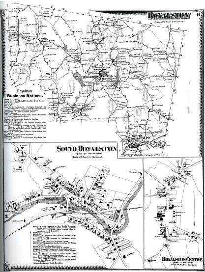
This map shows the north-central Massachusetts town of Royalston around 1870. Located in the northwest corner of Worcester County, Royalston's rugged, hilly terrain and rocky soil supported sheep-raising, dairy cattle, wood cutting, and family gardens. This was a typical "hill town" economy in Western Massachusetts at the time. As the lower map shows, by the late 19th century a small water-powered industrial center flourished along the Millers River in South Royalston. The best-known and most successful business was the American Woolen Company, which produced a fortune for the family of Alexander Bullock. Bullock served as the governor of Massachusetts in the 1890s.
|
Royalston
|


| |
Home | Online Collection | Things
To Do | Turns
Exhibit | Classroom | Chronologies | My
Collection
About This Site | Site Index | Site Search | Feedback