


Advanced Search
| Online Collection |
|
|||||||||||||||||||||
|
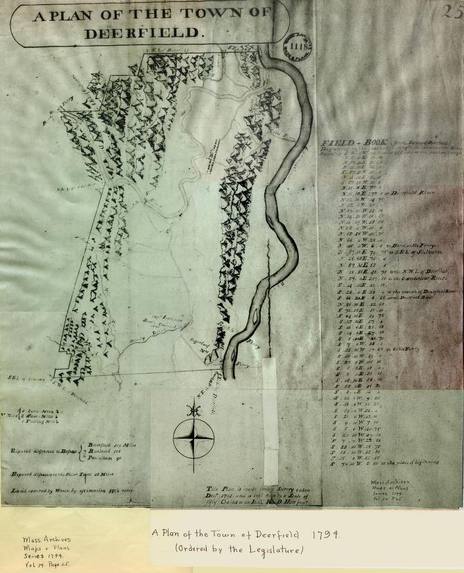
Hoyt's map carefully marks the boundaries of the town, shows the network of roads, and names the ferries across the Deerfield and Connecticut Rivers. At this time no bridges were around, and the Old Albany Road west of the village of Deerfield continued across the river at a ford or shallow spot in the river. The map also notes the locations of mills, and uses a different symbol for each type of mill. The village of Deerfield appears as the only settlement, although many outlying houses and farms were around at this time. Hoyt's drawing of hills to the east and west take over the landscape and give an idea of rough land.
|
"Plan of the Town of Deerfield"
|


| |
Home | Online Collection | Things
To Do | Turns
Exhibit | Classroom | Chronologies | My
Collection
About This Site | Site Index | Site Search | Feedback