

Advanced Search
| Online Collection |
|
||||||||||||||||||||||
|
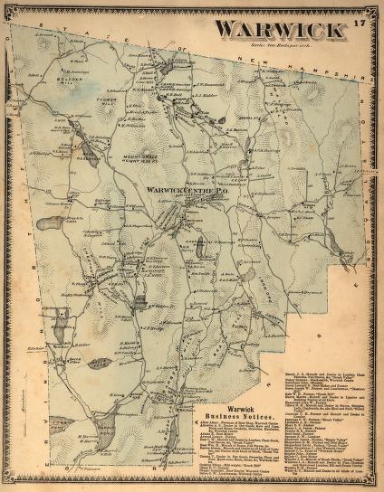
In 1871 the town of Warwick, Massachusetts, was beginning a long economic and population decline. By 1918, the industries identified on this map - lumber, staves and lath, and the boot shop - would be entirely gone, and the population of the town would have shrunk by nearly one-half. Many factors contributed to this decline, but the primary one can be seen here: there was no good transportation connection to the outside world other than the unreliable rural road network. Despite abundant water power, Warwick's industries were too far from its markets, unlike, for example, the adjacent town of Orange, whose industrial base in 1871 was beginning a rapid rise.
|
"Warwick"
|
| |
Home | Online Collection | Things
To Do | Turns
Exhibit | Classroom | Chronologies | My
Collection
About This Site | Site Index | Site Search | Feedback


