

Advanced Search
| Online Collection |
|
||||||||||||||||||
|
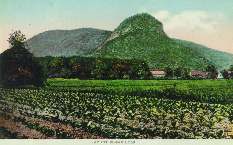
A settlement of paleo-Americans lived some 9,000 years ago on or near the spot where this photograph was taken. Around them rose low sand dunes left from the bed of Lake Hitchcock, dunes that were covered with grass or even forested. The Sugarloaf range, which ends with Mt. Sugarloaf, formed a natural path for migrating animals. Archaeological evidence also points to extensive fishing in the nearby Connecticut River. They probably supplemented their hunting with crops grown in the locally rich soil. It is not known how long they lived there. A later generation of Native Americans, the Pocumtucks, lived in the area. In their language Mt. Sugarloaf was called Wequomps. They tended an early version of the tobacco growing in the fields in this picture. From nearly the first time of European settlement, tobacco was tended in Deerfield and South Deerfield for local use. In the 18th century, tobacco began to be grown as a cash crop, and cigars were manufactured locally. By the early 1900s, the open-field tobacco pictured here was being displaced by the shade-grown variety.
|
Mt. Sugarloaf
|
| |
Home | Online Collection | Things
To Do | Turns
Exhibit | Classroom | Chronologies | My
Collection
About This Site | Site Index | Site Search | Feedback


