

Advanced Search
| Online Collection |
|
||||||||||||||||||
|
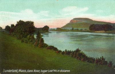
Mt. Sugarloaf rises to the north in this image taken from the town of Sunderland, Massachusetts, the broad expanse of the Connecticut River before it. Despite the presence of the river, the area around Sugar Loaf had never been heavily settled. It was far more valuable as agricultural land, a use that profited from the river's periodic heavy floods. Most western Massachusetts towns were sited above the river's floodplain, adjacent to more easily controlled tributaries that gave steady water power. Major floods in the 1920s and 1930s stimulated flood control projects that raised the bank of the river, including from where this photograph was taken.
|
Connecticut River, Mt. Sugarloaf in the distance
|
| |
Home | Online Collection | Things
To Do | Turns
Exhibit | Classroom | Chronologies | My
Collection
About This Site | Site Index | Site Search | Feedback


