

Advanced Search
| Online Collection |
|
||||||||||||||||||||||
|
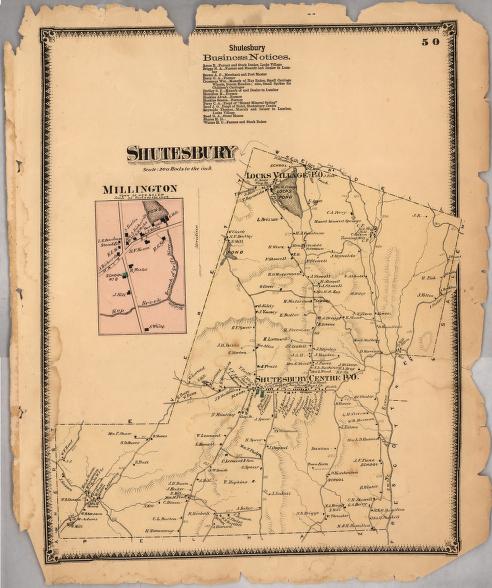
The Shutesbury, Massachusetts, of 1871 already shows the signs of its eventual decline. Its industry was limited almost entirely to sawmills located on the town's few streams or at the mouths of its lakes, such as Lock's Pond, now Lake Wyola. Shutesbury Center was able to sustain a hotel through its status as a transportation route between the bridge in Sunderland and points east. Today, the route east from Shutesbury is entirely blocked by the Quabbin Reservoir, which fills the valley of what was then the Swift River. Along its southeastern border is the now-vanished town of Prescott, also lost under the waters of the Quabbin.
|
"Shutesbury"
|
| |
Home | Online Collection | Things
To Do | Turns
Exhibit | Classroom | Chronologies | My
Collection
About This Site | Site Index | Site Search | Feedback


