Send an E-Postcard of:
"Montague"
(c) Pocumtuck Valley Memorial Association, Deerfield MA. All rights reserved.
Contact us for information about using this image.
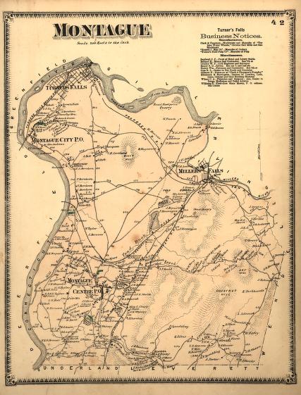
This map of Montague, Massachusetts, in 1871 caught the town at a crucial stage of its existence. Then, the town's population was almost evenly distributed between the three major centers: Montague Center, Millers Falls and the Turners Falls/Montague City corner. The character of the town changed dramatically in the years immediately following 1871. The manufacturing center of Turners Falls grew dramatically in the 1870s, prompted by its ready access to rail lines, its proximity to a navigable section of the Connecticut River, and the abundance of water power the river afforded. To its east, Millers Falls also grew in size and by comparison, Montague Center would remain a rural village. Its hilly eastern half then, as now, remained very rural, although logging in the late 1870s and 1880s would deforest much of it; forests have since grown back.
top of page
|
|


